The Camino Portugués
From Redondela to Santiago de Compostela
Lisbon to Porto
Porto to Redondela - Coastal Route
Porto to Redondela - Central Route
▶ Redondela to Santiago
Variante Espiritual
Accommodation Directory
Getting into town and out again is straightforward. There is an alternative route that is signed, which takes you through town closer to the river.
As a city, Redondela has its charms. It sits well inland of the Vigo estuary and is bisected by two massive train bridges.
When leaving town, the camino crosses the N550 at a bottleneck on the north side of town that is heavy with traffic at all hours. Cross the N550 as soon as you get to it, and almost immediately veer left gently onto a side road.
The arrows from here leave a bit to be desired. They are present, but have been spray painted with a not quite right yellow and at times, they don’t feel legit. Follow them all the same, and as you near Cesantes the stone markers return.
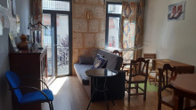
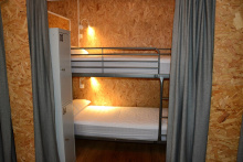
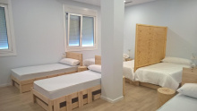
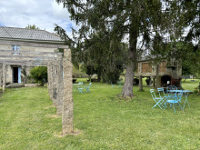
Accommodation in Redondela.
| Albergue Rosa d'Abreu 20€ 6 Booking.com |
|
| Albergue Alfonso XII 17€ 12 Booking.com |
|
| Albergue A Conserveira 15-16€ 40 Booking.com |
|
| Albergue A Rotonda 17€ 9 Booking.com |
|
| Albergue A Dársena do Francés 20*€ 29 Booking.com |
|
| Albergue Santiago Apóstol 12€ 30 Booking.com |

|

Getting past Cesantes means crossing the N550 once more, at probably the most dangerous point in a curve in the road. Head straight across and keep to your right.
You are climbing uphill now and will traverse around the O Viso peak. Along the way you pass an installation of pilgrim shells and if you have a marker on hand you can leave a message on a sun-bleached shell. From here it is downhill again to the N550.
At the entrance to Arcade, the camino turns left rather unnecessarily. It will cross back over the N550 in a few hundred meters, taking you past the albergues and shops of Arcade.
Accommodation in Cesantes.
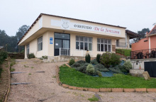
| O Refuxio De la Jerezana 18€ 34 Booking.com |
|
| Albergue A Dársena do Francés 20*€ 29 Booking.com |

|
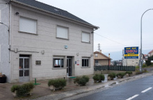
| Pensión Jumboli Booking.com |
|

If you fancy a dip in the sea or just a stroll along a beach, Arcade and Pontesampaio (a bridge away) will oblige. Follow the camino to the bridge over the estuary where you will find a strip of sand on both sides.
Accommodation in Arcade.
| Albergue Lameiriñas 13€ 26 |

|
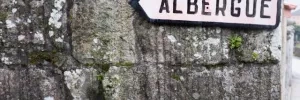
The hotels here are located along the main road, which is both noisy and a bit dangerous. Suitable as a last resort but otherwise best avoided.
After crossing the bridge, take a left turn on the first street. This turn is followed by a series of zigs and zags that take you up and through town at the highest point.
The camino takes a welcome break from the road traffic between here and O Pobo.
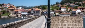
In O Pobo / Santa Marta an alternative route into Pontevedra presents itself on the left side of the road.
Turn left to follow signs towards the Rio Tomeza. This path is 3.6 km to the Pontevedra Albergue (at the start of town near the train/bus stations), and the original road route to the same point is 2.8km.

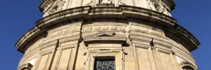
Your entrance to the old town center of Pontevedra is punctuated with its most famous church, the Iglesia de la Virgen Peregrina, a shrine to the Pilgrim Virgen who guided pilgrims here from Baiona.
To see the rest of Pontevedra’s notable buildings will required you to stray from the arrows a bit. The old town is not large enough to get lost in, so take your time and enjoy the many plazas and parks.
The most important landmarks are the Convento de San Francisco, the Basilica de Santa María (often referred to as the Cathedral), the Iglesia de San Bartolomé, and the Convento de Santa Clara.
There are plenty of plazas to choose from, including the large Plaza de Teucro and the diminutive (and best) Plaza de Leña.
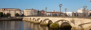
Leave by crossing the Ponte do Burgo and heading straight-ish through the next roundabout, turning left immediately after. Before long you will be alongside the railway, which you will cross just before the church of Alba.
TWO WAYS TO PONTECESURES / PADRÓN
There are two routes to Pontecesures/Padrón from Pontevedra, and the split occurs about 3km after crossing the bridge in Pontevedra.
The original camino keeps on its inland trajectory and is currently the most popular choice among pilgrims. It is also the shortest.
The second option is known as the Variante Espiritual and it turns westward to cross over the Monte Redondo as it heads towards the sea at Vilanova de Arousa. From here you have the option of a 3rd day of walking to Pontecesures or a trip by boat up the Ría to the same place. This variant was created and named by the local tourism sector and although the stories told about its origins are fantastic, they are also just that... stories. Don’t let this clever bit of marketing discourage you though, the route is recognized by the Pilgrim Office as an official variant and you will not have any difficulty obtaining your Compostela regardless of whether you take the boat or not.
This recognition, and lots of praise from pilgrims, means that this route is growing in popularity.
VIA THE VARIANTE ESPIRITUAL - 44. km on foot + 28 km on foot or ferry
The Variante Espiritual is an alternative route which connects Pontevedra with Pontecesures. It adds 8.2km of walking (and a significant climb to the top of the Monte Redondo) and another 28km by boat (from Vilanova de Arousa to Pontecesures).
Getting started is as simple as turning left at the well signposted fork in the road. The way almost immediately begins climbing upwards, though gently at first. It is making its way back to the Ría de Pontevedra, going up and around a small monte before arriving in the waterfront town of Combarro. There is one small hamlet before arriving at Cabaleiro, and it has a bar/shop with a very limited selection, but as it has odd hours it is not included here as being reliable.
THE ORIGINAL CAMINO, INLAND VIA CALDAS DE REIS - 36.3 km
This is the easiest to navigate and shortest of the options. From the split simply carry on straight.
Accommodation in Pontevedra.
| Albergue de Peregrinos (Virgen Peregrina) 10€ 56 |
| Aloxa Hostel 19-25€ 60 |

|
| Slow City Hostel 20-23€ 6 Booking.com |

|
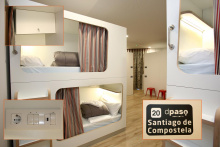
| dpaso Urban Hostel 18+€ 20 Booking.com |
|
| GBC ISAPE 19+€ 40 Booking.com |

|
TWO WAYS TO PONTECESURES / PADRÓN
There are two routes to Pontecesures/Padrón from Pontevedra, and the split occurs about 3km after crossing the bridge in Pontevedra.
The original camino keeps on its inland trajectory and is currently the most popular choice among pilgrims. It is also the shortest.
The second option is known as the Variante Espiritual and it turns westward to cross over the Monte Redondo as it heads towards the sea at Vilanova de Arousa. From here you have the option of a 3rd day of walking to Pontecesures or a trip by boat up the Ría to the same place. This variant was created and named by the local tourism sector and although the stories told about its origins are fantastic, they are also just that... stories. Don’t let this clever bit of marketing discourage you though, the route is recognized by the Pilgrim Office as an official variant and you will not have any difficulty obtaining your Compostela regardless of whether you take the boat or not.
This recognition, and lots of praise from pilgrims, means that this route is growing in popularity.
VIA THE VARIANTE ESPIRITUAL - 44. km on foot + 28 km on foot or ferry
The Variante Espiritual is an alternative route which connects Pontevedra with Pontecesures. It adds 8.2km of walking (and a significant climb to the top of the Monte Redondo) and another 28km by boat (from Vilanova de Arousa to Pontecesures).
Getting started is as simple as turning left at the well signposted fork in the road. The way almost immediately begins climbing upwards, though gently at first. It is making its way back to the Ría de Pontevedra, going up and around a small monte before arriving in the waterfront town of Combarro. There is one small hamlet before arriving at Cabaleiro, and it has a bar/shop with a very limited selection, but as it has odd hours it is not included here as being reliable.
THE ORIGINAL CAMINO, INLAND VIA CALDAS DE REIS - 36.3 km
This is the easiest to navigate and shortest of the options. From the split simply carry on straight.
Exercise caution passing through San Caetano as the road is quite narrow and the traffic is quite fierce. At the end of town turn right off the road. Soon you will be along the railway once more which you will follow along for several kilometers.
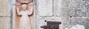
San Amaro sits square above the railway that you walked along a few kilometers ago; they tunnel through this hillside on their way to Santiago.
There are two bars in town; the first has the most character and the most business. Friendly service too.
Turn left at the fork in the road, past the park, and onto a country lane.
The turn off for the Portela/Barro albergue is along this stretch, and it takes you uphill to the right.


Located along a deviation of the camino, well signed. It adds a few meters to the journey but has a municipal albergue in a quiet town.
Before arriving at Briallos, the camino approaches the N550 once more. At this point, there are signs for the Natural Park of the Rio Barosa, and the waterfalls. The waterfalls are 500m down the road directly opposite this point and are a worthwhile detour. Picnic areas and a bar and bathroom are at the base of the falls.
The albergue and the bar are located a few hundred meters from the center, turn left when you get to town, following the signs. Otherwise, keep on straight to the end of town.
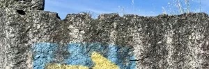
Caldas de Reis is best known for its hot springs (caldas). They still exist, but the tradition of putting your feet into the fountain is discouraged for obvious hygienic reasons. All the same really, a hot soak after a hot day of walking isn’t the best of plans. To see the springs (and to follow the camino), turn left after crossing the first bridge in town.
The camino passes through the old quarter before arriving at another bridge, on the opposite end of which is the municipal albergue and the way out of town.
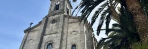
The church in town is dedicated to Saint Thomas Becket, one of very few of the sort in Spain and possibly the only one in Galicia. If you are only passing through town in the afternoon, the palm trees that surround the church make for a cooling place to relax.
On the way out of town, it is once more along the N550 (which frankly will be the case frequently between here and Santiago). Leave it to your right at the first bend in the road.
Accommodation in Caldas de Reis.
| Albergue A Queimada 14€ 74 Booking.com |

|
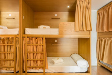
| Albergue GBC Caldas 25-28€ 100 Booking.com |
|
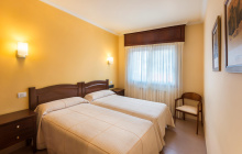
| Hotel O Cruceiro 16-18€ 34 Booking.com |
|
The way to Santa Mariña is through a quiet forest away from the busy road. The bar here is quite friendly and a welcome morning stop if you have left from Caldas.
The camino crosses the N550 to the upper part of town to visit the church, and returns to cross again before Casalderrique.
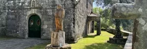
The camino only touches the back side of O Pino, which has a bar and an albergue a bit off the track (200m). The albergue here is large and clean and friendly, with a shaded park in front.
Accommodation in O Pino (Valga).
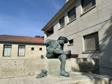
| Albergue de Peregrinos Valga 10€ 78 |
|
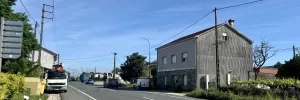
There is not much to San Miguel apart from the modest church and the bar-grocery-everything store. The quaint countryside walking will soon give way to the sprawl of Pontecesures.
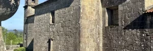
A small church on your right, and on your left a kids playground and recreation area. Not too hidden in the park is an ancient petroglyph. These are common throughout Galicia and more are discovered every year. The bar is at the far end of the small town.
The camino leaves town along the road but quickly picks up a track as it descends through the hamlet of Fragmoreira. It emerges on a roundabout at the divided highway you have crossed over a few times. Keep to the left as you approach Poio.
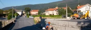
The first building in town is the rather imposing Monasterio de San Xoán Poio. Further along, as you descend from the monastery, there are several bars.
The camino descends from the Monastery and turns right at the bottom of the hill. Mind the traffic here, there are no barriers and not too many arrows. Follow the road to the first crosswalk and turn left to pick up a smaller country road.
Here there is one tricky turn. Shortly after crossing the road keep an eye open for a narrow path that turns upward on your left-hand side, it is right before a small B&B called A Marchanta. Follow it upward, then turn right, and then left at the fork onto a small dirt track.
This track leads you to the waterfront and a large park which plays host to all manner of celebrations, do not be surprised to find it full of teenagers hungover from a late night of partying or packed full with caravans. The arrows are not bountiful here but keep the water to your left and cross to the far end of the park where a paved road takes you uphill to join the main road.
This road is very busy and parked cars make for plenty of blind spots. Keep to the left as best you can and soon you will arrive at Combarro.
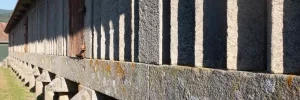
Combarro might just be one of the most charming and quintessentially Galician villages on the whole coast. Fishermen have worked these seas for centuries, and the horreós that line the coast (and which appear to hover just above the waterline) were used to dry fish as well as grain.
The town is small and compact and the camino does not actually see the best parts, to get to them keep going straight where the camino turns uphill to the right to join the road. It would be hard to get lost in Combarro, but if you do deviate from the camino be aware that there is another variation whose arrows might lead you very much astray.
The Variante Espiritual crosses the road and immediately begins its ascent of the Monte Redondo. The climb varies in intensity from extremely steep to gently rolling and back again. Go gently.
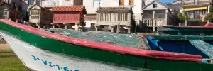
Not well signposted, but noticeable for the large dirt parking lot adjacent to it. The mirador platform doesn’t inspire much confidence but does offer some excellent views East over the Ría de Pontevedra.
From the mirador the camino levels out a bit and follows along a mountain track. It eventually joins a paved road but only for 250m when it crosses the road and begins the descent into Armenteira.
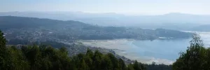
The camino delivers you directly to the front door of the Monasterio de Armenteira and to the two bars in town. Directly in front of you is the more popular of the two. The albergue is set off from town by a few hundred meters, follow the camino arrows and they will lead you to the albergue.
From Armenteira the camino joins a popular (among locals) trail known as the Ruta de la Piedra y del Agua. It follows along a creek, with trails on both sides, as it descends to sea level. Along the way, it passes several dozen abandoned water mills. Note that although you can safely and easily follow both sides of the river, it is the right-hand side that keeps you closer to the mills and the water.
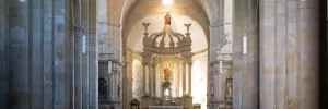
Large picnic area and recreation space. There are public bathrooms here, and during the summer months there is a small bar/kiosko.
The riverside walk is interrupted by a large highway and associated roundabouts, but no sooner than you pass them do you return to the trail.
There is a small bar (seasonal) on your left as you reach this junction. There is a larger bar/restaurant just over the river.
As you approach Puente Arnelas you need to follow the arrows that lead you up a steel and wood walkway under the belly of the bridge. At the top, turn right to get up to the road level and follow it into the small village. A short ways on the camino joins the broad Río Umia.
A small village with a small chapel and a large pharmacy. There are bars at both ends. If both are closed, there is a gas station if you are in a pinch.
The camino ahead includes a small climb up through the town of Gombra. It also follows the road for a short stretch before turning left into the small village of Mouzas. There are a few more hamlets along this stretch before the camino arrives at a large crossing of the PO-549. Here there is a pair of bars, including the happy for hamburgers Mississippi Bar.
Cross the road towards Cores.
Just beyond Cores the camino arrives at last to the sea, and the last 3km are along sandy paths with beaches on your left and beach bars on your right. The camino keeps close to the water and arrives at Vilanova by way of a large bridge.
Vilanova is a lovely seaside harbor town with plenty of bars and food options but not much more besides gazing out to sea.
THE BOAT. Everything you need to know about the boat to Pontecesures is impossible to print here. The schedule varies with the tide, the number of passengers, and the whims of the captain and the hospitalero at the albergue (he who makes the arrangements). The matter is complicated by the fact that the same captain helms two boats of different sizes and capabilities and there is a daily calculation to maximize profit. Unfortunately, this means that there is little that you can do to plan it days in advance, and more or less need to turn up at the albergue and arrange things with the hospitalero.
THE ROAD. The alternative to the boat is a predominantly roadside walk along a path that roughly mirrors the coastline but doesn’t provide for much contact with it. The arrows are lacking in certain areas and the accommodation along this stretch should only be relied upon during peak Summer months and with a reservation.

Pontecesures is the town that you wished was prettier but isn’t. It enjoys a nice riverside location but is spoiled by the belching factory across the river.
The arrows go under the road and over the bridge and across the Río Sar to Aduana. Here it runs all the way into Padrón.
Accommodation in Pontecesures.
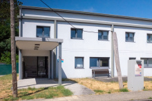
| Albergue de Peregrinos Pontecesures 10€ 54 |
|

Herbón, and the Monastery and Albergue there, could not be better placed for a peaceful day of relaxed contemplation at the end of the penultimate day of walking to Santiago.
It is a deviation from the camino’s yellow arrows, but one imagines that it has always been an important stopping point for pilgrims.
The albergue here is run by the Galician Amigos of the Camino and it is one of the few places where you can count on eating dinner with all of the other pilgrims staying there.
To get there simply follow the red arrows marked Herbón. This detour if for anyone wishing to spend the night in the Albergue at the Monastery of Herbón (recommended). From Pontecesures it is 2.7km, with an additional 3km the following morning to bring you to Padrón. In all this detour adds 3.1km to the official route.

Padrón might just be the most important little town on this or indeed any other camino. It was here that the remains of Santiago arrived after being sent out to sea on a stone boat, as told in the story of the ‘translatio’.
His arrival to the specific point is attributed to the fact that it was here that he first arrived to preach while still alive, so his return was a homecoming of sorts.
Padrón is also the birthplace of Rosalia de Castro, Galicia’s most famous and beloved laureate.
Padrón (and Herbón) are home to that delicious green and possibly spicy pepper you may have had the pleasure of eating.
Take a look at the elevation profile for an idea of what these last 24km will be like, many pilgrims underestimate the elevation changes which increase as you near Santiago.
Accommodation in Padrón.
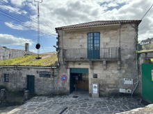
| Albergue de peregrinos de Padrón 10€ 46 |
|
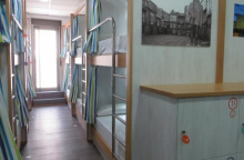
| Albergue Corredoiras 15-19€ 17 Booking.com |
|
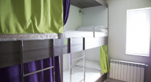
| Albergue Camiño Do Sar 15-17€ 20 Booking.com |
|
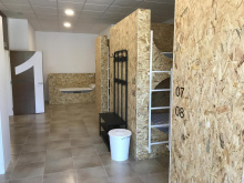
| Albergue O Pedrón 14-17€ 44 Booking.com |
|

Pass through Pazos, Rueiro, Tarrio and Vilar (albergue); none with services.


