Saint Jean Pied de Port is the nexus of several Caminos de Santiago that spread out across mainland Europe, and it was from here (primarily but not exclusively) that pilgrims most frequently made the crossing into the Iberian peninsula.
The tradition remains and the small town is often saturated with pilgrims, and pilgrim related tourism, during most of the year. With so many newly minted pilgrims roaming the streets, it has an air of excitement mixed with apprehension and a touch of dread.
You are advised to have a reservation before arriving, and the same holds true for the very few accommodation options that exist between here and Roncesvalles. If reservations are not part of your plans, march on with the philosophy that the camino provides, as it so often does in the most unexpected of ways.
Landmarks to explore include the Citadelle at the top of town, the Porte de San Jacques, and the Notre Dame du Bout du Pont. Look to the cobbled streets for the well-trodden plaques that point the way to Santiago de Compostela.
Before you set off for the Pyrenees and the border crossing into Spain be certain to pick up a pilgrim’s credencial at the pilgrims office (Rue de la Citadelle). This accordion-fold booklet is your passport to the camino and will become your most cherished souvenir of the trip. It is a required document in most pilgrim-specific accommodation, earns you pilgrim prices in many museums, and will serve as proof of your journey when presented to the Pilgrims Office in Santiago if you are planning on getting your Compostela Certificate.
It is important to be aware of the dangers of weather between here and Roncesvalles. These mountains have claimed more than a few lives, including several in recent history. If you have any questions regarding the journey ahead, the volunteers at the pilgrim office are there to help and advise.
Saint Jean Pied de Port, or Donibane Garazi as it is known in Basque (remember that the French border aside, this town was once a part of Lower Navarre and the Basque language is as common here as it is over the pass), was founded in the late 12th century by the Kings of Navarre and served as the capital.
Market day in Saint Jean Pied de Port is Monday, which is also one of its least busy days for pilgrims.
The distance between here and Roncesvalles is the most physically difficult stretch of road you are likely to encounter on the whole of your camino. From the “Foot of the Pass,” it is a steep climb for the first 8km to Orisson, then it is mostly uphill (but not very steep) for most of the French part. It becomes flat before Roland's fountain and the Spanish border.
A beautiful path - which is steep only at the beginning - leads directly though the forest down to Roncesvalles, while the longer option via Ibañeta (turning right from Lepoeder), isn’t a path, but a narrow asphalt road, which can be quite unpleasant.
The Valcarlos Route - 23.5 - 27 km
The length of this route varies based on how much of it is walked strictly on the camino; 23.5 if you walk entirely on the camino and 27km if you follow the camino to Valcarlos but continue on the road thereafter... which will be necessary during times of heavy snowfall or ice. This route has an undeserved reputation as being the backup to the Napoleon Route, it is anything but. Crossing the Pyrenees is both beautiful and challenging regardless of the route taken. This route takes you though the welcoming village of Valcarlos, where the albergue has functioning heating and where the views are superb.
The Napoleon Route - 24.3 km
The Napoleon Route is the longer of the two and covers small mountain roads and trails. It was popularized as a way to bypass the banditry that was all too common in the valley below. You will soon see that up in the mountains, there are few places to hide.
WARNING: THIS ROUTE IS CLOSED FROM NOVEMBER 1st to MARCH 31st ALWAYS. During years of heavy Spring snowfall, this closure will be extended further.
UPDATES: The pilgrim office in are able to provide up-to-the-minute information on both routes.
Accommodation in Saint Jean Pied de Port.
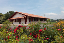
| Chambres Zazpiak Booking.com |
|
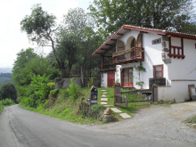
| La Coquille Napoléon 18-20€ 10 Booking.com |
|


The distance between here and Roncesvalles is the most physically difficult stretch of road you are likely to encounter on the whole of your camino. From the “Foot of the Pass,” it is a steep climb for the first 8km to Orisson, then it is mostly uphill (but not very steep) for most of the French part. It becomes flat before Roland's fountain and the Spanish border.
A beautiful path - which is steep only at the beginning - leads directly though the forest down to Roncesvalles, while the longer option via Ibañeta (turning right from Lepoeder), isn’t a path, but a narrow asphalt road, which can be quite unpleasant.
The Valcarlos Route - 23.5 - 27 km
The length of this route varies based on how much of it is walked strictly on the camino; 23.5 if you walk entirely on the camino and 27km if you follow the camino to Valcarlos but continue on the road thereafter... which will be necessary during times of heavy snowfall or ice. This route has an undeserved reputation as being the backup to the Napoleon Route, it is anything but. Crossing the Pyrenees is both beautiful and challenging regardless of the route taken. This route takes you though the welcoming village of Valcarlos, where the albergue has functioning heating and where the views are superb.
The Napoleon Route - 24.3 km
The Napoleon Route is the longer of the two and covers small mountain roads and trails. It was popularized as a way to bypass the banditry that was all too common in the valley below. You will soon see that up in the mountains, there are few places to hide.
WARNING: THIS ROUTE IS CLOSED FROM NOVEMBER 1st to MARCH 31st ALWAYS. During years of heavy Spring snowfall, this closure will be extended further.
NOTICE: Both routes will be closed during thunderstorms, at which point pilgrims are obliged to wait for the storm to pass.
UPDATES: The pilgrim office in are able to provide up-to-the-minute information on both routes.
The Napoleon Route - 24.3 km
The Napoleon Route is the longer of the two and covers small mountain roads and trails. It was popularized as a way to bypass the banditry that was all too common in the valley below. You will soon see that up in the mountains, there are few places to hide.
During times of poor weather, this route will be closed. When the skies are clear you can see for miles, otherwise you are not likely to see past the horses and sheep that pasture here.
First bar stop and first accommodation option. Reservation is recommended.
Not far beyond Honto the camino leaves the asphalt road for the first time, and winds steeply uphill over the course of several switchbacks.
The Kayola albergue, operated by the Orisson albergue, is located where these switchbacks return you to the road.
From here the camino is almost entirely on the asphalt road until you reach the Collado de Bentartea.

Orisson is a common stopping point for pilgrims wishing to split the walk over the pass into more manageable sections.
If you arrive here late in the day don’t just pass on by. Drop in and inquire about the weather, and if you choose to continue on make it clear to somebody that you are doing so. If it is anywhere near nightfall (within 6 hours), consider changing your plans to stay on this side of the pass.
Last minute reservations in Orisson, as well as the Borda albergue 1.5km further up the road, are difficult to achieve. An alternative is to a dangerous crossing is to return to Saint Jean via taxi, and to return the same way to Orisson the following morning.
WARNING: Fill up your water here. There is no guarantee of a water supply beyond this point. You are advised to take at least 2 liters with you.
Accommodation in Orisson.
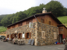
| Refuge Orisson 45**€ 38 |
|

Accommodation in Borda.
| Auberge Borda 43**€ 12 Booking.com |
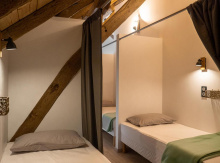
|
The Virgin stands at the Pic D'Orisson.

Also known as Napoleon’s Pass. There is often a small food truck which sells drinks and snacks, and which offers the last stamp in France.

Navarra is the first of the Spanish Autonomous Communities along the Camino Francés. It extends from here, in the heights of the Pyrenees to the river plains of the Ebro on the outskirts of Logroño.
The language in these parts is officially Spanish and Basque. The signage here reflects that sentiment. Most towns have an alternative name, and if the authorities have not corrected the spelling you can be sure that someone with a spray can has.
You will as well see that the street names have dropped the castillian ‘Calle’ for the basque ‘Kalea.’
The Valcarlos Route - 23.5 km
The Valcarlos Route follows close to the road and is the advised route during poor weather. It passes through two towns (with services) located directly on the road between here and Roncesvalles, and two villages that are not on the road and which have no services.
In Arnéguy you will cross the main road (D933) and the bridge. The way will lead you to a country road that is lower in the valley and which will bring you to Valcarlos from the lower part of town.

To get to most services in town you will have to follow the road a short distance back in the direction of Arnéguy.
The church here is of a modern design and is often locked up. This is frequently the case, particularly in the rural corners of Spain. If you are comfortable asking around, usually at the nearest bar, somebody will know somebody with a key. They will almost always open up for pilgrims.
Domingo de Resurrección - Easter Sunday. In Valcarlos the Resurrection is celebrated with dancing and singing and draws a considerable crowd.
You will leave town along the main road, eventually abandoning it for a smaller road on your left. Gañecoleta is less than 1km from the departure from the main road.
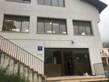
Accommodation in Valcarlos.
| Albergue municipal de Valcarlos 15€ 24 |
|

From here the way to the pass is quite steep, particularly the last few kilometers.
Commonly referred to as Roncesvalles Pass and home to the modern Ermita de San Salvador de Ibañeta. The pass has existed as an important crossing point since Roman times and was one of the principal crossings into the Iberian peninsula. From here it is all downhill into Roncesvalles, 1.6km.


Both Routes rejoin in Roncesvalles
Commonly referred to as Roncesvalles Pass and home to the modern Ermita de San Salvador de Ibañeta. The pass has existed as an important crossing point since Roman times and was one of the principal crossings into the Iberian peninsula. From here it is all downhill into Roncesvalles, 1.6km.


The popular dining spot is at the Posada, and you can buy a ticket for dinner at the albergue. The dining room sees pilgrims from all over the world sit down at random to fill the tables. Half of them are about to begin their walk, which starts here, while the other half have just descended from the mountain. The difference is in the length of their stride. Dinner is also available at the hotel.
It doesn't take much to see the whole village, and almost every building is a treasure of some kind.
Near the albergue is the Iglesia de Santa Maria, where a mass for pilgrims and a blessing take place every day at 8 p.m. (6 p.m. at weekends). The Real Colegiata de Santa María de Roncesvalles is also a must-see, but the relics and other remarkable objects are part of the Museum (small price).
The small Capilla de Santiago o de los Peregrinos and the Silo de Carlomagno (also known as the Capilla de Sancti Spiritus) lie side by side along the road.
Roncesvalles is the scene of the epic battle between Roland and Charlemagne's rearguard. The Basques ambushed and destroyed the guard, Roland perished, and a legend was born. Centuries later, the church would capitalize on the name, and the abbey here would control an important territory up and down the valley, all the way to Pamplona.
The day of the Virgin of Roncesvalles is celebrated every year on September 8. Romerías (a local pilgrimage) take place on Sundays in May and June, and on the Wednesday before September 8.
The camino starts on a path to the west of the main road (your right-hand side), heading into the forest before returning to the road as you approach Burguete.
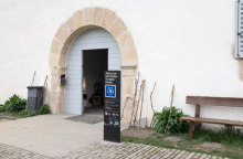
Accommodation in Roncesvalles.
| Refugio de Peregrinos de Roncesvalles - Itzandegia 14€ 183 |
|

Immortalized by and little changed since Ernest Hemmingway lodged here 1924. He was on a fishing trip, no doubt catching some of the trout that swim these rivers and which luckily for us end up on more than a few dinner tables.
The architecture here is typically Basque; massive multi-generation family homes with a name or a crest above the door.
There is a very nice and friendly bar/panaderia at the beginning of the village, opposite Guardia Civil and the supermarket. It opens very early in the morning, even before 7 in summer and the coffee is very good. Another bar adjacent to the church is not likely to be open in the early morning.
San Juan is celebrated the 24th to 26th of June. Other festivals include one for the Arts on the second Sunday of August, and another for Farming on the last Sunday of September.
Keep your wits about you when walking through town because the camino takes a sharp right turn halfway through. There are no less than twelve yellow arrows marking the turn, but it can still be overlooked by those admiring the charm of Burguete.
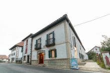
Accommodation in Burguete.
| Lorentx Aterpea 16€ 36 Booking.com |
|

Between here and Pamplona, you will notice many villages perched above the valley floor. This was to maximize both farmland (shared and more fertile near the river) and security.
The founding of Espinal was driven by the desire to protect pilgrims. This river valley has a long history of battle and banditry, and it was in the interest of the Navarran Kings (in this case Teobaldo-II) to keep them safe.
Several more villages along the way share a similar founding, and Teobaldo was not alone in improving the infrastructure of the camino. Indeed, several other Kings, Queens, Saints, and modern politicians all share a common interest in promoting the camino.
The last Sunday in August.
Accommodation in Espinal.
| Irugoienea 12€ 21 Booking.com |
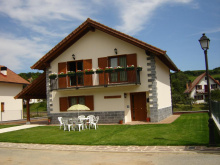
|
| Albergue Haizea ★★★ 15€ 30 Booking.com |
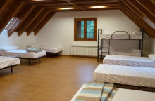
|
| Camping Urrobi 5.15€ |
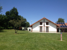
|


There are a number of bars in town, including El Dragón Peregrino which has a few vegetarian and vegan options. The supermarket is at the far end of town.
![Photo of Bizkarreta [Gerendiain] on the Camino de Santiago Photo of Bizkarreta [Gerendiain] on the Camino de Santiago](/sites/default/files/styles/100x300/public/newimages/819-134837.jpg.webp?itok=7vyANMig)
The bar has highly irregular hours as it is not generally open to the public.
When you get to this town, be sure to follow the arrows that direct you to the right and uphill. If you get to the main road (the N-135) you have gone wrong. The climb is fairly steep leaving town but flattens out through the forest. It brings you up to the Alto de Erro.

There is a food truck which provides seasonal service to pilgrims, and which has a nice multicolored stamp.
The descent from here to Zubiri can often be slippery after a rain, but do not follow the road as an alternative.
Zubiri, like Larrosoaña ahead, is adjacent to the camino and not strictly on it. You do not need to cross the bridge if you don’t plan on stopping here. If you do go into town, retrace your steps and turn right once back over the bridge.

Two restaurants offer pilgrim menus. They are on opposite ends of town, the first near the main square and the other down the road. The shop here offers everything you need to put together a meal, it is next to the church.
On extremely busy days, the polideportivo (sports complex) that is adjacent to the municipal albergue is used to accommodate pilgrims.
The name Zubiri comes from the Basque word for both bridge and pueblo, and the bridge they spoke about is the one over the river Arga known as the Puente de la Rabia. The bridge itself was thought to cure rabies and hydrophobia in animals, and rituals of crossing the bridge with them or circling its base a number of times were all that it took to work miracles. These miracles were later Christianized and attributed to Santa Quiteria.
Accommodation in Zubiri.
| Albergue Zaldiko 15€ 24 |
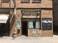
|
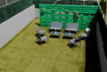
| Suseia 17€ 12 Booking.com |
|

You can take the road or the trail out of Zubiri. The trail, which passes a belching magnesium plant, can get quite soggy during wet weather.
Four hundred meters from Ilarratz on the right-hand side of the road lies La Abadia de Ilarratz (the abbey). The medieval building, rumored to have been a fort, was converted to a church in the early 16th century. A pilgrim bought it and is currently busy with a project to save the buildings. Pilgrims are welcome to pop in and say hello. They are also welcome to rest in the shade of the garden.
Accommodation in Ilarratz.
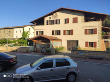
| Hostel Acá y Allá 20€ 12 Booking.com |
|

Going into Larrosoaña is not strictly necessary unless you are staying at the albergue or dropping in for food. If you have arrived here via the road from Zubiri and are eager to return to the trail, just pop over the bridge and turn to your right.
The grocery has minimal hours and stock.
Like Zubiri, Larrasoaña has a bridge which is well known, though for less beneficial reasons. Instead of healing, it was a frequent point of banditry; the name of the bridge is the Puente de los Bandidos . This is an important concept to keep in mind if you find yourself trying to imagine the life of a medieval pilgrim. All across Spain the stories of banditry appear, and when they do there is most often a river involved.
Modern pilgrims can hardly complain about the state of river crossings, but the medieval pilgrim would frequently find himself (depending on the century) with a more difficult situation. The rivers themselves grow in size as you continue westward, and some of them look quite daunting indeed. They were a natural choice for a more nefarious crowd looking to exploit pilgrims.
A bridge, whatever its design or age, is a wonderful thing indeed.
Larrasoaña has a long history of hospitality to pilgrims; though you would not guess such from its current state. An Augustinian monastery and two hospices for pilgrims served the pilgrimage for the better part of 8 centuries. Sadly, little remains. Two chapels, dedicated to St. Blaise and St. James, are all that exist of the once large and powerful brotherhoods dedicated to the care of pilgrims that once existed here and which made Larrasoaña an important stop along the way.

A small Basque hamlet, notable only for the large rural hotel. Leave the paved road for a dirt track here.

The Parada de Zuriain is the popular breakfast spot for pilgrims. Good food, artisan tortillas, and a deck overlooking the garden and riverside make it a fine spot.
The camino joins the main road here but not for more than 700m before turning left onto the first road. Along the road you are likely to find herds of spandexed cyclists. This stretch of asphalt was where Spain’s most famous cyclist Miguel Indurain trained to win his five Tour de France titles.
Accommodation in Zuriain.
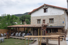
| Albergue La Parada de Zuriain 15€ 5 |
|

Between here and Zabaldika the camino splits, and each of those splits also split and sometimes rejoin.
From Irotz you have two choices:
1. The most obvious but least exciting option is a concrete river path leading to the area de descanco. From this rest area you have another choice: climb the hill towards Trinidad de Arre, or go left on the longer but flatter meandering river path to Huarte and from there to Pamplona.
2. A smaller path that is also marked with a camino signpost leading to Zabaldika. Poor Zabaldika is bisected by the N road though and once you get there you will have to make another choice:
2A. Go left to join option 1 near the area de descanso.
2B (the cultural route). Cross the N road and make the small climb to upper Zabaldika. Here you will find the 13th.C. church of St. Stephen, an albergue, and wonderful hospitality. From upper Zabaldika you can continue west towards Trinidad de Arre, and you will rejoin option 1 shortly after it leaves the area de descanso.
The area de descanso is a basic roadside rest stop, which is handy but not half as practical as visiting upper Zabaldika where you can also get a rest.

The somewhat confused signs through Zabaldika are the result of local politics interfering with tradition. In this case, the ayuntamiento has managed to one-up the culturally significant Iglesia de San Esteban and the original Camino Francés. To follow the original way, turn right in town and look out for the signs which take you across the main road and up a trail to the church in the upper half of Zabaldika. There is no need to retrace your steps, as the other camino does the very same some 100m down the road.

At the picnic area adjacent to the road you can choose your own adventure. The majority of walkers continue onward and upward. Optionally you can follow the river, keeping it on your right, on an alternate route into Huarte (albergue municipal, all services) and on to Pamplona (bypassing Trinidad de Arre, Villava, and Burlada). This route is marginally longer than the other, but does bypass the very obvious ascent from here.
The pair of buildings here are the Palace of the Lords and the Iglesia de Santa Marina. Neither are open to the public but there is place enough for a rest or a picnic before tackling the suburbs of Pamplona.
The camino passes through a tunnel beneath the highway and then climbs up and around the Monte Miravalles before nearing Trinidad de Arre.
Crossing over the río Ulzama you arrive to the district of Arre. Trinidad de Arre marks the point where you begin a mostly urban walk into Pamplona.
The camino here is joined by another from Bayonne to the northeast. It is an uncommon route by most measures, but if you find yourself among a few new faces, you may just ask them if they came along the Camino Baztán.
The albergue which is at the far end of the bridge is historically significant. Not only is it one of the oldest continually running albergues on the camino but it is also one of the most complete medieval monasteries in Navarra.
The next 7km are through the suburbs into and out of Pamplona.
Accommodation in Trinidad de Arre.
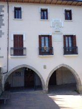
| Albergue de Trinidad de Arre 10€ 32 |
|

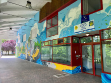
Accommodation in Villava.
| Albergue Municipal de Villava 23*€ 54 Booking.com |
|
The border between Burlada and Pamplona is the río Arga, which is spanned by the Puente de la Magdalena. Since Trinidad de Arre the terrain has been flat. From the bridge here you get your first glimpse of Pamplona’s defenses, both natural and man-made.
14th century bridge, restored in the 1960s. The albergue Casa Paderborn is along this river. Turn left after crossing if you plan to stay there.
Modern Pamplona is the most populous city along the Camino Francés. It offers just about every service you might need along the way. Its main square, the Plaza del Castillo was renovated in 2003 and is the easiest point from which to get your bearings.
Hemingway helped put the city back on the map and into the minds of many. He visited frequently and wrote kindly of the place. Some of his old haunts are still around (Bar Txoko, Hotel La Perla, and Café Iruña).
As is usual in every Spanish town with a large tourist population, the best food is found off the beaten path. Luckily, that is a quick stroll down Calle San Nicolás on the west side of the Plaza.
Pamplona is worthy of a rest day to see the sights, or perhaps a half day. Near the entrance to town is the Neoclassical Cathedral de Santa María el Real, your credential gets you a discount on the Cathedral and the attached Museo Diocesano. Another church of note is the fortified Iglesia of San Saturnino.
Pamplona is the first city along the way with a post office (Correos ⨠), perfect for lightening your pack. The post office here can help you send your stuff to the Santiago post office, or to Casa Ivar (the same Ivar as the popular ‘Camino Forums’’). He offers package and luggage receiving & storage in Santiago. Prices range from 15-25€, depending on the size of the package. When you arrive in Santiago, stop by Ivar´s office and pick it up. Opening hours are listed on casaivar.com, or you can email Ivar at ivar@casaivar.com.
Pamplona has been a city of importance since the year 75 BC. It was then that the Roman general Pompaelo set up camp at what has always been a geographically strategic point. That the camino passes through Pamplona is no coincidence, the geography dictates that it ought to.
As such, some would say that Pamplona’s history was written by the hills which have forever funneled Pyrenean traffic through this point. Indeed, it has a long and complicated history of conquest and reconquest, and for the 5 centuries that followed its capture by the Muslims in 718 little changed. They were eventually expelled from the city (but not the region) by the Basques and for the subsequent 200 years the power struggles that ensued were primarily motivated by the desire to keep them from regaining control.
By the 12th century things had calmed down enough for the city to begin growing in earnest, and again its geographic position made for a unique situation. It was by all measures a melting pot of cultures, with Basques from both sides of the French border, Castillians, Jews, and the remaining Muslim population each carving out a barrio for themselves. Cooperation was scarce, and the city survived a cycle of growth and destruction as each group struggled to defend themselves while attacking the others. The situation was so intense that Pamplona has the distinction of being one of the few cities with defensive walls within the city, rather than around it.
Pamplona enjoys its fiestas. The most notorious of them is San Fermín (think of men running from bulls) from July 6th - 14th. The municipal albergue is closed during that time, and accommodation elsewhere is hard to find and an order of magnitude more expensive. If you are keen on the experience plan well in advance, otherwise just pass through town with a watchful eye on your belongings.
There is a saying that the people of Pamplona cannot go a full year with celebrating San Fermín, so to help they also celebrate San Fermín Txikito (or Chiquito, or San Fermín de Aldapa) on the weekend closest to the 25th of September when the church celebrates the martyrdom of San Fermín. No bull.
The camino leaves town via the star-shaped Citadel that rose up during the 17th century (much like the citadel in Saint Jean Pied de Port, as both were based off the designs of the same French military engineer). If you are lost, find your way to the park which surrounds the citadel. The camino is well marked from there.
Accommodation in Pamplona.
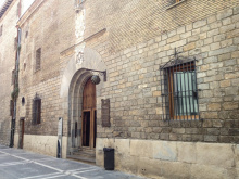
| Albergue Municipal de Peregrinos - Iglesia de Jesús y Maria 11€ 112 |
|
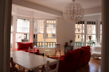
| Aloha Hostel 25€ 26 Booking.com |
|
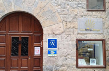
| Albergue Casa Ibarrola 20€ 20 Booking.com |
|
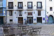
| Albergue Plaza Catedral 19€ 42 Booking.com |
|
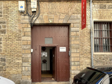
| Betania Donativo€ 20 |
|
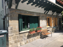
| Albergue Casa Paderborn 7.50€ 26 |
|

![Photo of Pamplona [Iruña] on the Camino de Santiago Photo of Pamplona [Iruña] on the Camino de Santiago](/sites/default/files/styles/100x300/public/newimages/833-133795.jpg.webp?itok=S4Hhah81)
![Photo of Pamplona [Iruña] on the Camino de Santiago Photo of Pamplona [Iruña] on the Camino de Santiago](/sites/default/files/styles/100x300/public/newimages/833-133796.jpg.webp?itok=9i_2Tm14)
One restaurant, Asador El Tremendo, does a pilgrim menu for about 10 euro. The grocery store in Cizur MAYOR is a short walk to your west, though a smaller shop with basic staples is available in town.
The Hospitallers of Jerusalem (the Knights of Malta) cared for pilgrims between here and the Alto de Perdón. Later, when the Knights Templar disappeared, they also took over operations west of here in Puente la Reina.
The Romería (a sort of local pilgrimage) to the Santuario de Nuestra Señora del Perdón (the namesake of the alto ahead, see history inset below) is held on Easter Monday.
Accommodation in Cizur Menor.
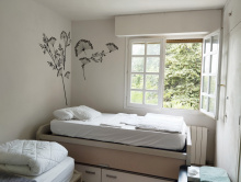
| Quiet Bright Room with Sunny Terrace 20€ Booking.com |
|
| Hostal Ardoi Booking.com |
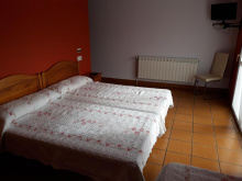
|
| Albergue de peregrinos de la Orden de Malta 7€ 27 |
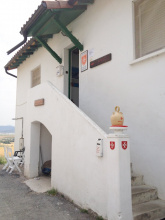
|

From here the climb is steady to the Alto de Perdón. If you have watched Martin Sheen’s “The Way” you may recognize the front of the Iglesia de San Andres as the setting for one of the movie’s earlier scenes.


At 756m the Sierras del Perdón are the highest point for the next 170km. Between going up, and going back down, it is the latter which requires more care and a sturdy foot.
The name derives from the chapel of Nuestra Señora del Perdon that once stood here. A legend tell us that it was along the climb to the alto where the devil tempted a thirsty pilgrim; offering to disclose the location of a fountain in exchange for his soul. The pilgrim refuses, and is rewarded later by Santiago himself who offers water at a much more “pilgrim friendly” price.


Accommodation in Uterga.
| Albergue Camino del Perdón 15€ 16 |
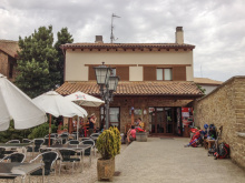
|
| Albergue Casa Baztan 14*€ 24 Booking.com |
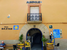
|

Octagonal 12th century Iglesia de Eunate.
The history of this ermita is still up for debate, and like most things in Spain are divided into two camps. Some believe it is of Knights Templar origin, and the rest believe it was a funeral chapel. Separate yourself from that intellectual debate and you will find a countryside setting with a small gem of architecture for you to contemplate.
SUMMER HOURS:
March 24th to June 30th
MON - SUN 10:30-14:00 / 15:00-19:00
July 1st to August 31st
MON - SUN 10:30-14:00 / 16:00-20:00
September 1st to October 14th
MON - SUN 10:30-14:00 / 15:00-19:00

Obanos is the real-life setting of a passion play that takes place here every even-numbered year at the end of July. It is a tragic tale of two saints.
The origins of the play are traced to the 14th century, when Santa Felicia, sister to the Duke of Aquitaine (San Guillén), left her home for a pilgrimage to Santiago.
The life suited her and when she arrived in Obanos she decided to devote herself to aiding pilgrims. Her brother set out on a mission of his own, that of bringing her back home with the lure of the comfortable lifestyle she had left behind. He was unable to do so, and in a fit of rage killed her.
Wracked with remorse, the young Duke decided to complete her pilgrimage in penitence. On his return journey, he holed up in the nearby hermitage of Arnotegui. He built a chapel there and continued the mission that his sister had begun.
The Iglesia de San Juan Bautista preserves the skull of Guillén.
The Mystery of Obanos - end of July on even numbered years, see history below.
Outside of Obanos, on the road to Puente la Reina, the Camino Aragonés joins the Camino Francés.
Accommodation in Obanos.
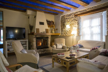
| Casa Rural Villazón Ii Booking.com |
|

There are a pair of churches in town that are worthy of a peek. They are the Iglesia del Crucifijo (with a rather distinct crucifix) and the Iglesia de Santiago (with its black Santiago). The best view of the old bridge is from the new bridge.
The name of this town is rather romantically attributed to the benefactor of the bridge over the río Arga. It is a nice sentiment, but not an altogether accurate one. In fact, historians quibble over which 11th century Queen had it built. One thing is for certain, banditry continued to present a problem to the growing town, and in the 13th century a wall was built to protect it.
It was rectilinear in shape and was not much bigger than the current town, and little remains:
1. Calle Cerco, ‘cerco’ being the word for wall. Of the 26 original towers most have become part of private homes, the best visible example is the stonework inside Hotel Cerco.
2. The city gate which opens to the bridge. Of the original 4 doors, it is the only one that remains.
Puenta la Reina celebrates Santiago as their patron, from July 24th to July 30th. They also have a few harvest festivals in September, including one which celebrates the red peppers that are grown in the hills between here and Eunate.
The camino leaves Puente la Reina by passing over its namesake bridge. From there it turns left, crosses the main road, and follows a footpath. Shortly, it begins a short but steep ascent on slippery-when-wet terrain. It is not uncommon to find cyclists pushing their gear upwards.
Accommodation in Puente la Reina.
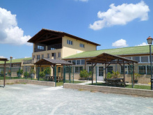
| Albergue De Peregrinos Santiago Apostol 12-14€ 100 Booking.com |
|
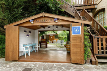
| Albergue Jakue 25€ 16 Booking.com |
|
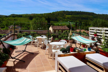
| Albergue Puente Para Peregrinos 16€ 32 Booking.com |
|
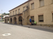
| Albergue de los Padres Reparadores 9€ 100 |
|

![Photo of Puente la Reina [Gares] on the Camino de Santiago Photo of Puente la Reina [Gares] on the Camino de Santiago](/sites/default/files/styles/100x300/public/newimages/840-200.jpg.webp?itok=0ovweJUp)
![Photo of Puente la Reina [Gares] on the Camino de Santiago Photo of Puente la Reina [Gares] on the Camino de Santiago](/sites/default/files/styles/100x300/public/newimages/840-133359.jpg.webp?itok=T_dlVy90)
Mañeru is a small village whose streets rival in confusion the best of labyrinths. Like the next village Cirauqui, it boasts a large number of impressive coats of arms carved into the large homes.
Expect a small celebration on the last weekend of June, and a larger one during the last week of August.

Cirauqui sits perched atop a small hill and it seems that everywhere you go is uphill. At the entrance to town is a medieval cross and at the top of town stands the Iglesia de San Román, the plaza, and an albergue.
Don’t forget to stamp your credentials under the archway.
Excavations in the surrounding area have turned up traces of a Roman settlement; a 2000-year-old milaro is preserved in the Iglesia de San Román, and the way out of town is over a Roman bridge.
The Day of the Cross is on the 14th of September, with a celebration from the 13th to the 19th.
Accommodation in Cirauqui.
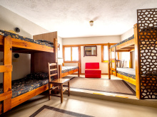
| Albergue de Peregrinos Maralotx de Cirauqui 18-20€ 25 |
|


The two bars in town are at the far end, near the main plaza/fronton court.
King García Ramírez, the grandson of El Cid, died here in November of 1150. The first guidebook to the camino tells that the waters here were poisonous to horses, in fact so too was the water in every stream between here and Estella and a few more beyond. It was propaganda at its finest, and the waters are perfectly safe.
Accommodation in Lorca.
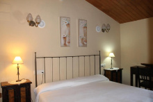
| La Bodega Del Camino 16.50€ 40 Booking.com |
|

You will pass through a brief section of modern rural expansion before crossing the río Iranzu by way of a double arched Romanesque bridge to enter the old town. Do pay a visit to the Iglesia de Nuestra Señora de la Asunción.
Food: For lunch, check out Bar Lara. At least one local describes the food as 'freakie good'. And for dinner Bar El Rebote. If you're just passing through and need a break or coffee, the polideportivo (sports hall at entrance to town) or the panaderia will suffice.
As far back as Puente la Reina artifacts proving previous Roman occupations have been uncovered. In fact, much of the road between here and there, apart from the stretches obliterated by the new A-12, was originally a Roman road.
The Virgen is celebrated on the 15th of August. The celebration of San Veremundo is held on the 8th of March.
Accommodation in Villatuerta.
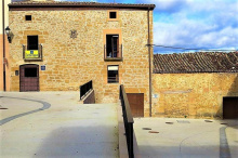
| La Casa Mágica 15€ 31 Booking.com |
|

Estella, in spite of not being a very big town, has a lot to offer. The camino enters along the river and keeps to the west bank. To see many of the churches, or to stay in some of the albergues, you will need to cross the río Ega.
The town boasts an impressive number of historically significant buildings, so many that to visit them all would take the better part of a weekend. The two not to be missed are the Palacio de los Reyes de Navarra (never actually used by the King of Navarra) and the Iglesia de San Pedro de la Rua. The others include the Iglesia de Santo Sepulcro (as you enter town on your left, closed since 1881), the Iglesia de San Miguel, and the Basílica del Puy which requires a climb to the top of town. Be sure to spend enough time wandering the streets to take it all in.
If you find yourself in Estella for a day of rest and exploration, there are some excellent walking trails nearby. Ask for maps in the tourist information office next to the Palacio.
Public bathrooms and drinking fountain at entrance to Estella, just past the first albergue.
Geographically speaking, Estella sits to the north of what would otherwise be an easy walk west from Villatuerta. Its growth as a commercial center developed not because of pilgrims (as was the case in most places) but rather at the manipulations of King Sancho Ramirez at the end of the 11th century.
Thursday is market day in Estella, just as it was 900 years ago. Be sure to stop by the Plaza de los Fueros (opposite the Iglesia de San Juan) for a fresh selection of just about everything in season across Spain.
Estella has two patrons, San Andres and La Virgen del Puy. The former is celebrated as “El Viernes de Gigantes” on the first Friday before the First Sunday in August. Giants abound, and there is a running of the bulls. The latter, for the Virgin, is celebrated on May 25th.
If you stayed in one of the albergues on the new side of the town, cross back over the river to rejoin the camino out of town.
Accommodation in Estella.
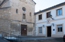
| Albergue Capuchinos Rocamador 14€ 54 |
|
| Camping Lizarra 5.62€ |
|

This town has grown to connect with Estella.
On the way out of Estella, look for the arrows at the second roundabout which direct you away from the road and onto a track which runs up and to the right, taking you behind the commercial shopping centers and into Ayegui.
At the end of town, BEFORE you get to a small park, blue signs with arrows point you downhill and to your left. Follow them, cross over the main road, and resume the camino towards to the Fuente de Vino and the Monasterio de Irache.
Accommodation in Ayegui.
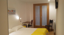
| Camping Iratxe Booking.com |
|
Sponsored by the nearby Bodegas Irache, there is a fountain here which pours both water and wine.
The plaque on the wall reads: “If you want to go to Santiago with strength and vitality, of this great wine have a drink and toast to happiness.” Greatness is subjective.
Another sign reminds you not to abuse their generosity.

The paper trail for the monastery leads back to 958, and it was the site of Navarra’s first pilgrim hospital. It is a large complex set in a landscape of vineyards. Like many other Benedictine monasteries across the peninsula, it has served as both a barrack to Napoleon’s troops, and as a hospital during the Carlist wars.
Free admission, but opens a bit late (10am) for pilgrims departing from Estella. The park opposite has picnic tables and nice shade trees.
The Monjardín is the peak that overlooks the town, and remnants of the 10th century Castillo de San Esteban that once protected it remain.
From March through October there is a small shop in front of the church that serves food.
The 11.7km between here and Los Arcos has a tendency to pass very slowly, and there are little opportunities for shade. Stock up well with water.
Accommodation in Villamayor de Monjardín.
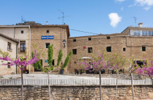
| Oasis Trails 12€ 21 |
|

For an early breakfast or coffee look to the main road (southeast of the church) where you will find a few bars that cater to early-to-rise pilgrims and early-to-work truck drivers.
The Iglesia de Santa María de la Asunción, located in the main square, is a radiant sight.
Los Arcos, a village dating back to its Roman occupation, is laid out in long streets which run parallel to the río Odrón. Your approach along the camino brings you into the north side of town, and it was on top of the hills to the east (left on approach) that the castle once stood.
It is a frontier town (Logroño is near enough) and as a result it saw its share of both destruction (at the hands of land-hungry nobility) and prosperity (every border crossing meant paying a toll, and exchanging currency, and most likely paying a duty on your horse).
Market day is Saturday. The locals also celebrate their patron Santa María from August 14th to 20th.
Exiting the town, you pass through the Arco de Felipe V and cross over the río Odrón. A few of the albergues in town are located on the west side of the river.

The yellow arrows have a tendency to keep to the road as they take you through this small village. To see anything of importance, including the church and many of Sansol’s several old baroque homes, turn right at the large ceramic tile sign indicating “Sansol” on the side of one of the first buildings.
To the right you will also find a small shop, and near the Palacio albergue a nice bar with a terrace.
Named after San Zoilo, a young man martyred in Cordoba under the rule of Diocletian in 304AD.
Incidentally, his relics are preserved in the Benedictine Monasterio de San Zoilo in Carrión de los Condes. The local church here is likewise dedicated to him.
Accommodation in Sansol.
| Palacio De Sansol 12-17€ 32 Booking.com |
|
| Casa Rural Martintxo |

Descending from the heights of Sansol into Torres del Río, one wonders why anyone would build a village in such an awkward to defend location. The only logical reason is the río Linares which gives the town its name and easy access to water.
The town is curious for the fact that nearly all of the buildings (at least their exteriors) have been restored, giving the impression that there are more (and more to do) people living here than there actually are.
Pay a visit to the octagonal Iglesia de Santo Sepulcro, which like the one in Eunate cannot escape references to a Templar connection.
The stretch between here and Viana has the nickname ‘The Knee Wrecker’ because of its frequent ups and downs. The only place for shade and pause is at the Capilla de la Virgen del Poyo where a seasonal food kiosk sets up shop.
Accommodation in Torres del Río.


Viana is a thriving city that serves as a good stopping point. A pair of albergues, a few churches, the occasional closing of the city streets to run with the bulls, and a handful of good restaurants offer a break from walking.
There is a nice green park, small but a great place to rest, on the west end of the town near the albergue and church ruins. It also offers great views of the plains to the west and the mountains to the north.
The restaurant Armendariz has a sidreria in the basement, where you can serve your own cider. To do so is a two person job whereby you position your glass near a bucket in the center of the room, and the person seated nearest the spigot in the wall lets flow an arc of cider on a trajectory towards said bucket.
Viana, being a frontier town along the border with La Rioja, has been built with obvious fortifications. The most strategic of these is its perch high above the surrounding hillside.
Although the city walls served their purpose well, holding off several prolonged sieges, the town changed possession several times since its founding in 1219. It did so largely with the shifting possession of the surrounding land.
Viana has no shortage of celebrations, and it is entirely possible that when you arrive the main street will be closed to everyone but bulls and mad men.
The most important: San Felices is celebrated on the 1st of February, Magdalena and Santiago from the 21st to the 25th of July. And the Fiesta for the Virgen de Nieva (snow), a movable feast that is celebrated from the Saturday to Wednesday that includes the first Sunday after the 8th of September.
Not long after leaving Viana you will have left Navarra behind and entered into La Rioja. The way into Logroño, its capital, is without much heavy industry.


The 17th century ermita, and the river that it sits along, are often considered to be the border to La Rioja. The actual modern day border is closer to Logroño but the paper factory that marks it is much less quaint than this ermita.
Nice picnic area and plenty of shade.

You have now left Navarra behind you, and the basque ‘feeling’ which has been fading since Roncesvalles will now disappear almost entirely. The widespread use of the name La Rioja, which first appears in a charter from 1099, is fairly new; prior to that, it was referred to as the province of Logroño. From a legal perspective, the name La Rioja was not legitimized until after the 1975 death of Francisco Franco when Spain transitioned into a democratic monarchy.
La Rioja is the second smallest autonomous community in Spain and the smallest along the Camino Francés. The camino will pass through several of its larger cities, including Logroño, Santo Domingo de la Calzada (which is next to the “río Oja”), and Nájera. It will also pass through several smaller villages, whose populations seldom exceed 200.
La Rioja has made its mark on the world as one of Spain’s largest producers of wine. Enjoy it while it lasts, which is only about 60km worth of walking along the camino. If that strikes you as too little, consider a detour to the Monasteries of Yuso and Suso; just enough to prolong your stay and explore some of the finest Monasteries around.
To the south of Logroño lies the town and castle of Clavijo. It was there in 844 during a battle between Ramiro I of Asturias and Abd ar-Rahman II of Córdoba that the legend of Santiago Matamoros was born. The legend tells of the return of Santiago (centuries since deceased remember) on a white horse and dressed for battle. Such a sight energized the Christian fighters (who had been on the losing side of the Moorish invasion) who went on to defeat Abd ar-Rahman. The scene is depicted in countless places along the camino, with Santiago riding high and the moors trampled underfoot.


