

Sevilla is a capital city whose laidback culture and seductive dance are quick to charm visitors. Give yourself an extra day of sightseeing here, or two, and get lost. Although it is the 4th largest city in Spain you will find that the Old Town is manageable on foot.
Within the tangle of streets are three UNESCO world heritage sites, including the largest Gothic church (the Cathedral), its oversized bell tower is known as La Giralda and it is a remnant of the original mosque that was torn down to make way for a Cathedral “so beautiful and so grand that those who see it finished will take us for mad.” Such a massive building makes for a good starting point for touring the city.
Apart from the Cathedral, the other not-to-be-missed architectural gem is the CAlcázar. A mix of Mudejar and Gothic styles, the palace complex was built by the Moorish dynasty but repurposed by King Pedro I.
Other landmarks of note include: the Metropol Parasol (known as the ‘mushroom of the incarnation’ and the largest wooden structure in the world), the Plaza de España (the single most photographed plaza in Andalucia) with the Parque de María Luisa adjacent, and the Torre del Oro (The Tower of Gold, built by the Almohad Caliphate in the 13th century as used as a prison and an anchor point for a chain which was strung across the river for defense).
If museums are your thing, or if you are simply trying to beat the heat, head to the Museo de Bellas Artes de Sevilla. It houses art and artifacts from the ecclesiastical properties that were shuttered by a 1835 Royal Decree. The Convento de Santa Paula and the Museo del Baile Flamenco are also good options.
The Vía de la Plata follows closely the Roman road and along the way you will have the opportunity to visit several well-preserved sites; however many have been moved off-site for preservation in the Museo Arqueológico de Sevilla.
If you don’t have one already, you can pick up a credential in several locations around Sevilla (tip: get two, the walk is long and the stamps are a great way to keep track of the journey). The Cathedral Parochial Office has them, as do several of the backpacker hostels (including Triana Backpackers). Also on the Triana side of the river are the offices of the Amigos del Camino de Santiago en Sevilla, where you can also ask about conditions of the path outside of Sevilla (important to know during the rainy season).
PERSONAL SAFETY: There is a fine line between issuing a fear-inducing warning and a casual mention of potential danger, and when it comes to the section of road on the outskirts of Sevilla something in between those two is necessary. There are a few places where the surroundings are quite run-down and although there have been no recent reports of trouble you are none-the-less likely to feel a bit anxious; keep your eyes open, keep to the arrows, and walk with a fellow pilgrim if you feel you need to... there is no need to walk in fear.
Despite its inland location, the big river hear has allowed the city to play an important role in the Spanish Empire’s global expansion. Christopher Columbus is resting here (in the Cathedral), and Ferdinand Magellan’s voyage around the earth began here too.
Sevilla’s slogan of ‘No me ha dejado’ (she has not abandoned me) is represented by the symbols NO8DO and you will find it flying overhead and emblazoned underfoot. The saying comes from King Alfonso X (the wise) who was supported by the Sevillanos during the civil war between Alfonso and his son Sancho. The 8 is not an 8, but rather it represents a skein of wool, known as a madeja.
In a major city the size of Sevilla you can always expect there to be a celebration of something going on, but the largest and most iconic one is the week of Semana Santa leading up to Easter. Reserve a room early.
CAMINO MARKERS: Be aware that there is no single official designation of the camino trail. Between Sevilla and Santiago, the camino is maintained by a number of local and regional governments, as well as by several ‘Amigo’ associations. Along the way, you will find yellow arrows, ceramic shell tiles (whose orientation may or may not be significant), bronze plaques embedded in the sidewalk, post-mounted street signs, striped trail markings, and privately made and installed signs. Seldom though will you find more than two of these in any given area and before long you will develop a sense of what to look for. When you cross from region to region, or when you enter a large city, be on the lookout for something new.
The markings of the camino in Andalucia come in the form of hand-painted yellow arrows, blue and yellow stickers, and ceramic tiles bearing a shell. In the case of the shell, the tile is oriented in such a way that you should walk in the direction of the ‘hinge’, which is to say towards the point where all of the lines converge. Note that this is not always the case in other parts of Spain, but the Amigos in Sevilla have done a good job of installing them as such. The camino begins at the Cathedral and makes its way to the Río Guadalquivir to cross at the Puente de Isabel II. This is the first bridge north of the Plaza de Toros. Once over the bridge, you have entered the barrio of Triana.
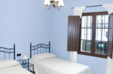
Accommodation in Sevilla
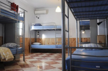
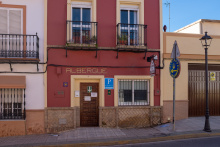
| Albergue Inturjoven Sevilla 15€ 300 Booking.com |

|
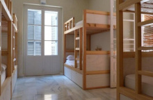
| Triana Backpackers 15€ 42 Booking.com |
|
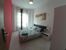
| Onefam Centro 18€ Booking.com |

|
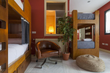
| The Nomad Hostel 18€ 38 Booking.com |
|
| The Spot Central Hostel Booking.com |
|
| La Banda Rooftop Hostel Booking.com |
|
| Hospedería Convento de Santa Rosalía 25€ |

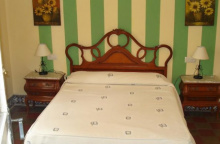
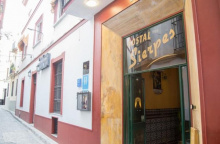
| Hostal Sierpes ⭑ Booking.com |
|


Once over the bridge, the camino turns right onto Calle San Jorge, and then right again onto the Calle Antillano Campos, followed by a left onto Calle Castilla which curves gently to the left. The arrows will direct you across a small paved square and up a broad set of stairs. Once at the top you will be facing a very large roundabout. Cross twice, keeping to the right both times (placing you on the diagonally opposite corner).
From here walk north (NOT over the busy bridge) along the road with a shabby looking parking lot on your left. You will soon cross part of that parking lot just before crossing the Río Guadalquivir (1.8km) for a second time. The way ahead is across the bridge, which is divided between a bicycle and pedestrian lane and a vehicular lane (traffic is oncoming but motorcycles tend to take a few liberties with the law, take note). Once over the bridge the camino splits into two routes of equal length:
1. THE RIVER ROUTE: This route has a reputation for being a bit unsavory, and it certainly does feel run down at the onset. Piles of windswept trash and the occasional squatter hut don’t lend it much credibility but it really is the more scenic of the two routes. That said, if you are uncertain it would not be the worst idea to walk with another pilgrim. During times of heavy rain, this route may be impassible. To follow the river route, turn right after crossing the bridge. The way is well marked and you will bypass nearly all of the industrial zone. CAUTION: When the camino returns to the paved road it does so at a roundabout which serves as a junction for the N-630 and there is a spray-painted yellow arrow indicating that you should turn right to go up the on-ramp. This is NOT the case, keep walking straight and under the highway towards the main road through Santiponce.
2. THE ROAD ROUTE (via Camas): This route travels through well-populated areas as well as through a long industrial estate and might be your only option following heavy rains. To follow this route keep on straight after the bridge. The arrows along the way are extremely faded but there are a few ceramic shells to keep you in the right direction. It is fairly straightforward: Keep on straight through a residential area full of bars and shops and play areas for children. Where this road ends turn right onto Calle José Payán (a narrow road). Follow it to the first large intersection, which is a roundabout known as Plaza Constitución and which is identifiable for the Iglesia de Santa María de Gracia. From the roundabout keep to the left (passing the church with it on your right) and continue all the way to a large roundabout. NOTE: This is a large roundabout and you have to get to the other side without the benefit of any protection rails, so be careful and go slow. Once on the other side, the camino follows a straight path through an industrial estate (though along a dedicated bike & hike lane). At the far end of the estate, it rejoins the river route and proceeds into Santiponce.

This route travels through well-populated areas as well as through a long industrial estate and might be your only option following heavy rains. To follow this route keep on straight after the bridge. The arrows along the way are extremely faded but there are a few ceramic shells to keep you in the right direction. It is fairly straightforward: Keep on straight through a residential area full of bars and shops and play areas for children. Where this road ends turn right onto Calle José Payán (a narrow road). Follow it to the first large intersection, which is a roundabout known as Plaza Constitución and which is identifiable for the Iglesia de Santa María de Gracia. From the roundabout keep to the left (passing the church with it on your right) and continue all the way to a large roundabout.
NOTE: This is a large roundabout and you have to get to the other side without the benefit of any protection rails, so be careful and go slow. Once on the other side, the camino follows a straight path through an industrial estate (though along a dedicated bike & hike lane). At the far end of the estate, it rejoins the river route and proceeds into Santiponce.

Roman history buffs should schedule an extra half day to visit Itálica, and non-buffs should do the same; the remains really are extraordinary. Before you get to the Roman parts, drop in at the Monasterio de San Isidoro del Campo. It is at the southern end of town and it would be a pity to pass it by. The visit is free, but they only open the doors on the top of every hour so try to get the timing right. Once you are done, continue north along the main road and follow the signs to the Teatro Romano. After that, continue north to the Amphitheater where another free visit awaits. Fans of Game of Thrones will recognize this site as the Dragonpit from season 8.
Santiponce stands upon and around the original Roman city of Itálica, which was founded in 206BC. It was here that two of the Roman Empires’ most celebrated emperors were born: Trajan and his adopted son Hadrian (off wall fame).
The camino leaves Santiponce along the same road that it came in on. Shortly after passing the archaeological site of Itálica it once again does a little dance around the highway on-ramps. Here, keep on this road to pass under the highway. Immediately after the last ramp (the northbound one), the camino splits but the split is not really marked.
The official route, at times flooded, leaves the road to follow a path on your left. This is the preferred route when it is passable and it is a straight path towards Guillena.
The alternate route adds about 5km to the camino but may be the only option after heavy rains. The start of it is not marked and you need only to continue along the road where the official route leaves it. Keep to the left side of the road and mind the traffic. The camino gets to the edge of a large town called La Algaba but doesn’t actually enter it. Instead, it skirts around the town to the left and you soon have the option to walk along a dirt path adjacent to the road.... or along the road if needed. Keep an eye open for the signs, and arrows, which will eventually lead you away from the road (left) along a dirt road. This path is well marked and used by service trucks for the local industry. It passes through citrus groves and the occasional cotton field before rejoining a different road to enter the village of Torre de la Reina.
Accommodation in Santiponce / Itálica


Torre de la Reina is an unassuming Andalucian village, whose cobbled streets are lined with orange trees that have been whitewashed to match the architecture.
The arrows in town lead you through the main square and right up to the A-8080. Cross it (towards Casa Esteban) and follow a side road to your right. Soon the camino returns to a rural setting and makes several twists and turns before arriving at the outskirts of Guillena.

Guillena is a modest-sized town, on maps for as long as maps have been made. Most services, and the private albergue, are located along the main road. The municipal albergue is next to the municipal swimming pools.
The private albergue Luz del Camino is on the main road about 50m past the turn mentioned below.
At the start of town laminated signs take you off of the main road. The Camino follows the Calle Real past the Iglesia de Nuestra Señora de Granada and eventually to the municipal albergue. If you miss those signs, or if you prefer to stay at the private albergue located on the main road, skip that turn. There are more arrows further up the road which will bring you to the municipal albergue.
Both the camino and the road will eventually cross the Río Huelva at which point the camino follows beside the road all the way to the first roundabout. Here, turn left towards the gas station to cross through a small industrial park. The camino returns to the groves for a quiet walk through the countryside.
Shortly before Castilblanco de los Arroyos the camino rejoins the main road. At the entrance to Castilblanco there are two options. To the right the camino follows the main road through town, passing a gas station, the municipal albergue, and several restaurants before leaving town along the road. To the left the camino goes through town along cobbled lanes, passing several bars and the church before rejoining the road out of town.
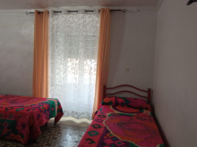
Accommodation in Guillena
| Albergue Luz del Camino 14*€ 25 |
|
| Hostal Francés | 
|


The stage between Castilblanco de los Arroyos and Almaden de la Plata is a very challenging and long day. There are zero places along the way to refill your water so be sure to carry extra with you along this stretch of nearly 30km.
The way out of Castilblanco de los Arroyos is along a path immediately adjacent to the road for the next 15km. It leaves the road at the entrance to a gated farm.
Accommodation in Castilblanco de los Arroyos
| Albergue de Castilblanco de los Arroyos Donativo€ 28 |
|
| Hotel Castillo Blanco | 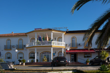
|

The gate to the municipal farmlands of Berrocal is usually closed. If it is, look to the right for a separate entrance for hikers. The camino from here to Almaden is along farm tracks and lanes. It descends to the Arroyo de los Zahurdones (4.7km) and includes a particularly steep (but short) ascent up to the Cerro del Calvario (6.4km). From there it descends into Almaden.


Almadén rests in a small but flat valley in the shadow of the surrounding Sierra Moreno mountains.
The road ahead is another 15km stretch without fountains, stock up in Almaden before setting off.
The camino is well marked through town and quickly returns to rural tracks; it follows a decidedly not straight path to El Real de la Jara as it attempts to go around the peaks rather than over them.
Accommodation in Almadén de la Plata
| Albergue juvenil Vía de la Plata de Almadén de la Plata 10€ 64 |
|
| Casa del Reloj 10€ 10 |
| Casa Concha Booking.com |

|

The castle overlooking El Real de la Jara makes for the perfect excuse to go for a bit of a climb, to take in the views, and to enjoy a fine sunset. It is empty inside but has been made safe for exploring.
About 1km after leaving El Real, the camino crosses a small creek which marks the entrance to the region of Extremadura. It continues to follow rural trails until El Culebrin and the adjacent 24h truck stop.
Accommodation in El Real de la Jara
| Albergue municipal La Casa del Cura 15€ 18 |
| Alojamiento del peregrino 11€ 10 |

|
| Alojamiento Molina 13€ 12 |
|

| Hostal La Encina ⭑⭑ 10€ 32 Booking.com |

|
